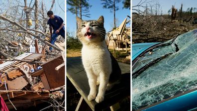
Volatile weather in the central and eastern US will hit high gear this week as a potential severe thunderstorm outbreak and life-threatening flooding loom large for tens of millions of people.
This next severe weather threat comes on the heels of the last, which tore through the central US on Sunday, killing seven people, and spread over nearly the entire east coast on Monday.
Some areas that were hit hard by those deadly storms – and the destructive storms last month – could yet again be in the path of violent storms late through to Wednesday (Thursday AEDT).
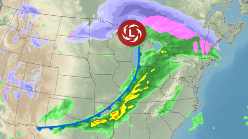
April is typically when severe thunderstorm season starts to pick up the pace, but destructive weather has already unfolded more often than usual this year. Storms from January through March generated more than 3200 reports of tornadoes, hail and damaging wind nationwide.
This week's storm will add to that eye-popping total. Here's what to expect:
Potential multi-day severe weather from Tuesday
A storm will push out of the Rockies and strengthen as it enters the Plains late on Tuesday (Wednesday AEDT). What happens next could invoke a strong sense of déjà vu.
The storm's northern, cold side will fire up the snow machine for the Dakotas and Minnesota while thunderstorms start to rumble farther south.
"A multi-day severe weather outbreak is possible beginning Tuesday afternoon through overnight Wednesday," the Storm Prediction Centre (SPC) warned.
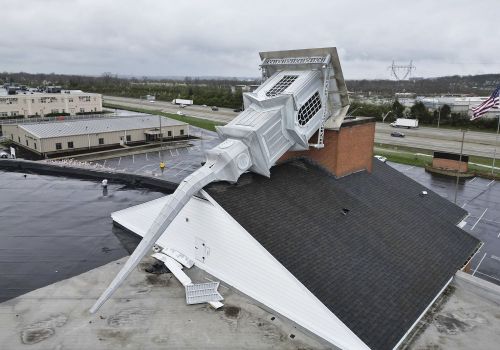
An expansive area from Texas to Iowa is under a level 2 of 5 risk of severe thunderstorms on Tuesday, according to the SPC. A more significant level 3 of 5 risk is in place in parts of Kansas, Oklahoma and Missouri.
Storms will develop in parts of the Plains late on Tuesday afternoon and strengthen, reaching more of the region by the evening before tracking east and hitting parts of the Midwest overnight.
Any storm could produce damaging wind gusts, hail and tornadoes, but some of the most volatile will be capable of more. Some storms in Kansas and Oklahoma could produce strong tornadoes – rated EF2 or higher – and large hail the size of coins to golf balls.
While the severe risk will mainly be confined to the Plains, the hazardous weather on Wednesday is expected to be more intense and could impact a much larger population.
A level 4 of 5 risk of severe thunderstorms is in place on Wednesday for more than four million people in parts of the Mississippi Valley. A more expansive level 3 of 5 risk is in place for more than 42 million people from Texas to the Great Lakes, including Dallas, Chicago and Indianapolis.
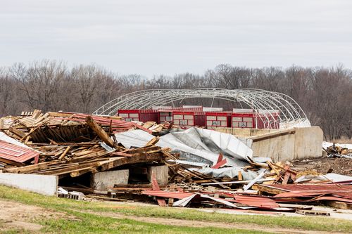
Thunderstorms in the Midwest could remain severe after sunrise, but how they behave during the first few hours of daylight will affect some of the region's severe threat the rest of the day.
If Chicago, for example, has stormy weather that lingers past the morning hours, it could prevent severe thunderstorms from forming over the city later in the day. But if the stormy weather clears out early, it will leave Chicago open to another, stronger round of thunderstorms starting in the late afternoon or evening.
Some thunderstorms will also linger on Wednesday morning in parts of Kansas and Missouri and will likely strengthen as they move east into the Mississippi Valley by the early afternoon.
Additional storms will develop by the mid-afternoon in the Mississippi Valley, some of which could undergo "explosive" development, according to the SPC. By the evening, severe thunderstorms could stretch from Louisiana and Arkansas to as far north as Michigan. A few more storms could develop overnight in Texas.
Damaging wind gusts, hail and tornadoes are possible in any storm, but the greatest risk for tornadoes – some strong and long-lasting – will stretch from Arkansas to Indiana and Ohio.
Many of these tornadoes could occur after sunset, increasing the danger they pose. Nighttime tornadoes are nearly twice as likely to be deadly as those occurring during the day, a 2022 study found.
The strongest storms could also dump up to baseball-sized hail in parts of the Mississippi Valley.
The storms will also deliver torrential rain that sets up a new, longer-lasting threat: flooding.
An entire spring's worth of rain could fall this week
A roadblock in the atmosphere caused by a stalled front will point a firehose of moisture from the Gulf right into the Mississippi and Ohio valleys and create a days-long, life-threatening flooding event this week.
An extreme amount of rain will fall through the end of the week that could lead to "generational" flooding in Arkansas, Missouri, Tennessee and Mississippi, according to the National Weather Service.
Level 3 of 4 risks of flooding rainfall encompass parts of the Mississippi and Ohio valleys each day from Wednesday through to Saturday, according to the Weather Prediction Centre.
"This is an increasingly significant setup" with the potential for "high impacts and life-threatening flash flooding spanning the course of several days," the centre warned.
After rain begins Wednesday, each day that follows will see the threat of flooding ramp up. The ground will get increasingly soaked until it becomes unable to absorb more and any rainfall after that point will set off dangerous flash flooding.
Storms will work over the same areas repeatedly and could drop 5cm to 15cm of rain each day – especially from Arkansas to Indiana.
In Pictures: Dozens killed as tornadoes, fires and dust storms rip through US
By Saturday, areas caught repeatedly under the heaviest storms could end up with more than 40cm of rain. The corridor where Arkansas, Missouri, Illinois, Kentucky and Tennessee meet is the most likely place for these extreme totals.
"If we get anywhere near these amounts, a historic flash flooding event is likely," the National Weather Service in Paducah, Kentucky, warned.
An entire spring's worth of rain could fall in just four days in the hardest-hit locations. Paducah, for example, averages about 39cm of rain from March to May.
The upcoming heavy rain event isn't the first period of extreme rainfall this season and likely won't be the last. Overwhelming rainfall is becoming more frequent in a warming world, as rising global temperatures push weather toward the extremes.
Last week, more than half a year's worth of rain fell in less than 48 hours and sent parts of South Texas underwater, forcing more than 100 water rescues and leaving four dead.

