The multiple devastating impact of floods across Europe
By Krisztián Szabó (Átlátszó), Konstantina Maltepioti (MIIR) and Kostas Zafeiropoulos (MIIR)
Flood data from the last decade show at least 681,076 people affected and 1,579 lives lost in Europe, while satellite data from the past two years reveal damage to farmland, roads, railways, pipelines, and communication infrastructure.
“The flood changed our lives. My children are scared every time it rains. My son had a panic attack when the bridges were closed again in Faenza, thinking that everything would happen again. Even I can't help but look at the river every time I pass over it. Now I live day by day. Everything can change in an instant. I lost everything in half an hour”
Francesca Placci, a resident of the Italian town of Faenza in the province of Ravenna, Emilia-Romagna. Faenza was flooded 3 times in 18 months.
Floods are the most common natural disaster. Their frequency has more than doubled since 2004 due to an accelerating hydrological cycle driven by human-induced climate change. Over the past 30 years, floods in Europe have affected 5,5 million people, caused nearly 3,000 deaths, and led to economic losses exceeding €170 billion. But these figures are only estimations.
We combined data from three distinct databases to construct the first comprehensive dataset, tracking floods, number of affected people, and deaths across European regions from 2014 to 2024. Moreover, we built a separate dataset based on satellite data from the past two years that shows the flood extent and its impact on land and infrastructure across member state regions.
Between 2014 and 2024, data collected from Copernicus, the public EM-DAT database, and Hanze database indicate that at least 681,076 people have been affected by floods across 24 European countries. However, the number of people affected is an understatement as data is not available for all floods. Based on the existing data we analysed, at least 1,579 people have died due to floods in Europe over the past decade.
According to the Institute for Environmental Research and Sustainable Development of the National Observatory of Athens, floods in the Balkans with more than 10 deaths occur once every 6,5 years and with more than 22 deaths once every 12 years.
On October 29, 2024, extreme rainfall caused severe flooding in the Valencian Community, affecting 53,260 hectares. Approximately 190,090 people were impacted, and 232 lives were lost. This disaster stands as the largest flood in Europe for 2024 and the most devastating in terms of human impact.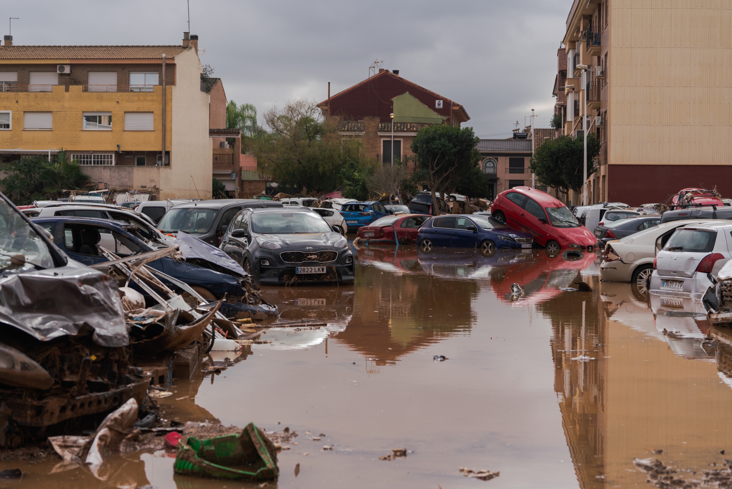
Flood in Valencia, Spain. Source: Guillermo Gutiérrez Carrascal / El Confidencial
As the floods in Valencia showed, the worst affected areas have lower per capita incomes and the houses built there, where land is cheaper, are less prepared to cope with this type of event.
Valencia is the third Spanish province with the highest number of buildings in flood-prone areas.
October 25, 2022October 30, 2024
Valencia province, Spain, before and after the flood.
Source: NASA Earth Observatory
Over the past two years, 17 European countries have faced 32 floods, impacting a total of 427,336 hectares—an area 1.5 times larger than Luxembourg—according to satellite data from the Copernicus Rapid Emergency Service.
Analysis of 61 impacted regions reveals rural areas experienced the most extensive flooding, with approximately 138,663 affected hectares. In comparison, 98,447 hectares were affected in intermediate regions and 88,468 hectares in urban regions.
Almost 82.5% of the total affected land concerns agriculture and natural ecosystems. Floods have impacted approximately 327,666 hectares of agricultural land, making up 76.7% of the total affected area. This includes arable fields, pastures, permanent crops, and heterogeneous agricultural areas. This significant land loss highlights the severe impact floods have on farmers' livelihoods.
The largest flood in Europe the past two years began on September 5, 2023, in Greece's Thessaly Region, affecting nearly 122,375 hectares—92% of which was agricultural land. The storm claimed 17 lives, affected 44,000 residents across Karditsa, Trikala, Magnesia, and Larissa, and resulted in the deaths of over 200,000 animals.
Our data shows that Thessaly also faced the most significant transportation damage in Europe over the past two years, with 1,590 km of roads and nearly 149 km of railway infrastructure affected.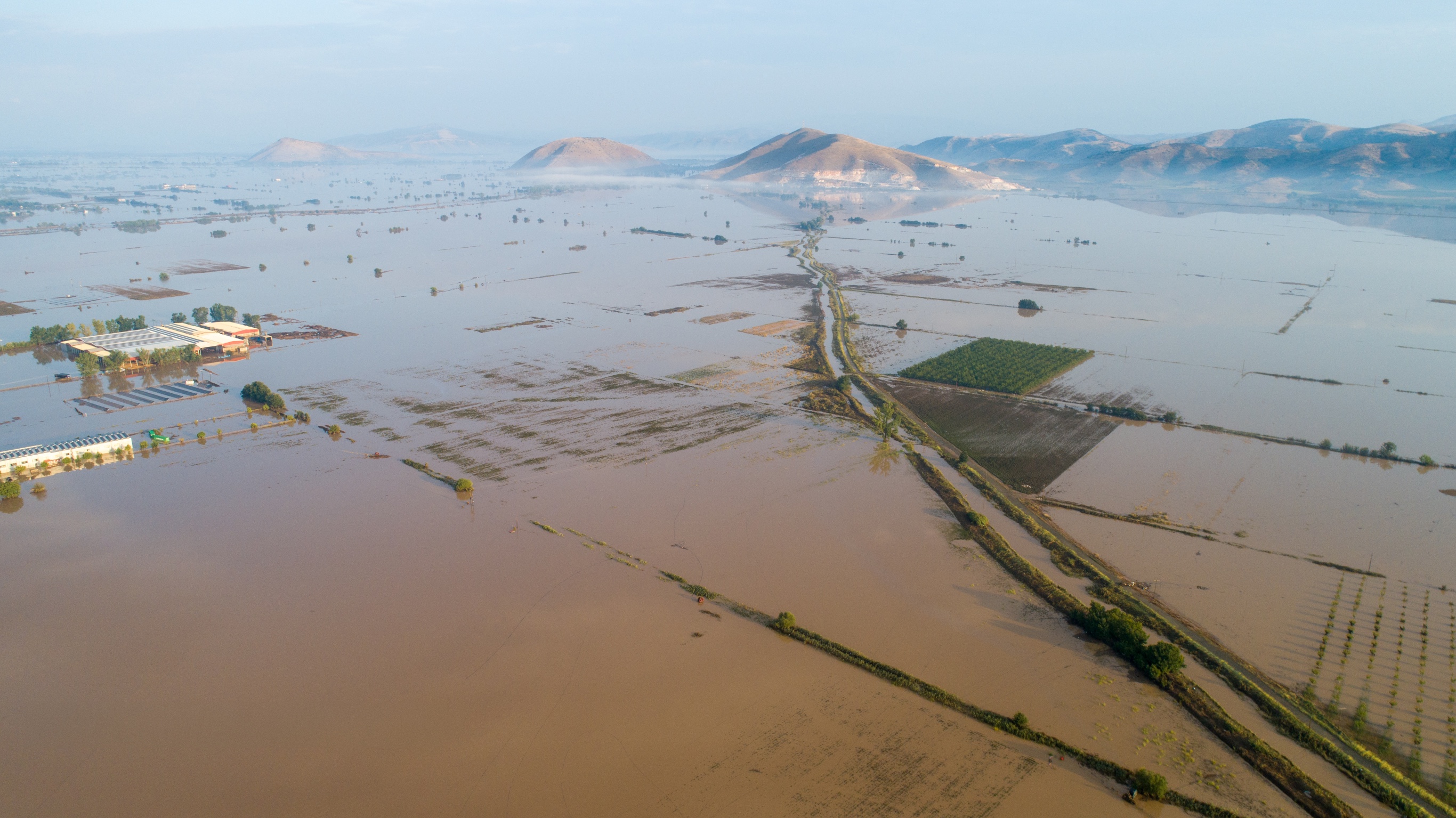
Flooded plains near the town of Palamas, Thessaly, Greece. Source: Makis Theodorou
The official death toll after the catastrophic flood of 2023 in Thessaly was 17. However, a recent study by the Centre for Research and Training in Public Health, Health Policy and Primary Health Care, shows that the actual number of associated total deaths was 20 times higher in the first quarter after the floods. A total of 335 people died within 3 months due to cardiovascular and/or respiratory-related issues.
August 31, 2023September 8, 2023
Thessaly's most affected areas before and after the flood.
Source: NASA Earth Observatory
Floods have damaged a total of 4,256.2 km of transportation infrastructure, spanning roads, railways, maritime infrastructure, urban transport, and aviation. Local roads account for nearly 67% of the total damage, with urban areas experiencing the most significant impact on road infrastructure.
In addition, another 6,885.4 km of narrow paths and trails, predominantly in rural areas, have also been affected.
Over the past two years, flooding has also affected 1,223.6 km of pipelines and communication infrastructure, mostly in predominantly urban regions. This includes 845.9 km of long-distance pipelines, communication, and electricity lines, along with 377.7 km of local pipelines and cables, which resulted in homes being left without electricity and drinking water.
The data shows that while rural areas experience larger flood extents, urban regions suffer more severe infrastructure damage.
Germany’s pipeline and communication infrastructure has been affected the most, reporting 209.8 km of affected long-distance pipelines and electricity lines, and 117.7 km of affected local pipelines and cables.
All together, floods in Brandenburg, Baden-Württemberg, Bavaria, Lower Saxony, Saxony, Saxony-Anhalt, and Saarland in Germany the past two years have affected 327.5 km.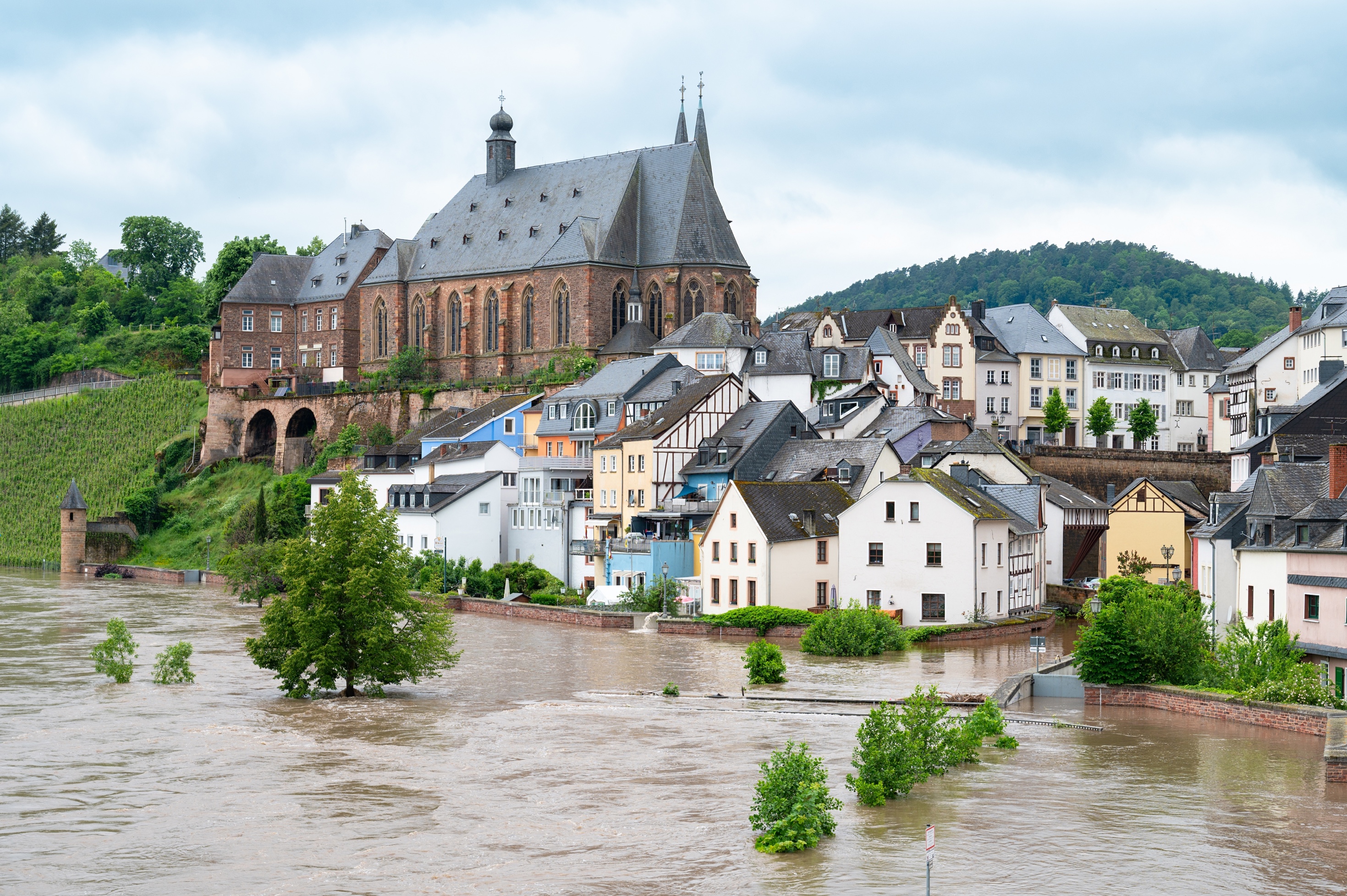
Flood of the river Saar, in Saarland, Germany, 18.05.2024. Source: Berit Kessler / Shutterstock.com
December 2020December 30, 2023
Weser River North near Bermen, Germany, before and after the flood.
Sources: Google Earth, Brockmann Consult
Overall, in the past two years, 32 floods have impacted 427,336 hectares across 17 countries, affecting approximately 320,560 people. Notably, the flood in Valencia, a predominantly urban region, accounts for 59.3% of the total estimated affected people.
While rural areas suffer larger flood extents, urban areas, with their higher population density, often see more people impacted. However, without data on the economic impact of floods, it's impossible to determine which communities truly bear the heaviest burden.
The past three and a half decades have been among the most flood-rich periods in Europe in the last 500 years. Scientists have shown that this era differs from other flood-rich periods in terms of magnitude, air temperatures and flood seasonality. The summer of 2024 was the hottest on record in Europe and globally. For every degree Celsius added to the average global temperature, the intensity of rainfall increases by about 7%.
It’s very likely that another major flood will hit European soil in the next few years, similar to those in Valencia, Faenza, Thessaly and Central Europe. However, Europe seems unprepared to deal effectively with floods on its territory.
In civil protection, early warning systems are the most important thing. But this does not mean that it is enough for the authorities to give an early warning for people to evacuate. They need to know where the flooding is going to occur, where the real risk is, and have the time to manage the volumes of water in order to protect not only the people but also animals, property, and critical public infrastructure.
MIIR's and EDJNET's data journalistic research, attempts to fill a gap in a landscape of fragmented and incomplete European flood data. In the face of the threat posed by the ongoing climate crisis, this research highlights the urgent need for an official comprehensive and regularly updated dataset tracking floods across European regions, not only for improving preparedness and resilience but also for effectively managing the consequences of flooding.
Created by: Krisztián Szabó (Átlátszó)
Data collection & analysis: Konstantina Maltepioti (MIIR)
Research: Kostas Zafeiropoulos (MIIR)